Spatial science provides key insights for public health

UChicago Lab sheds new light on health inequalities on our communities
By Sarah Fister Gale
Throughout the pandemic, poor and minority neighborhoods have faced higher rates of infection, hospitalization, and death from COVID-19, a trend far from unique as socioeconomic factors have long been tied to disparities in healthcare and health outcomes.
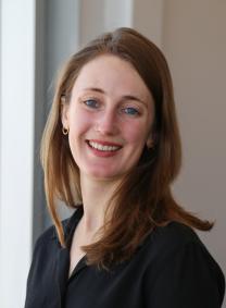
“More than fifty percent of health is due to non-genetic factors, so there are many reasons different neighborhoods experience different health outcomes,” says Marynia Kolak, assistant director for health informatics in the Center for Spatial Data Science at the University of Chicago.
Kolak is also the principal investigator of the Healthy Regions + Policies Lab (HeRoP), a recently launched University project using geography, spatial statistics, and spatial epidemiology to study and understand social determinants of health in diverse communities, and how those insights can positively impact public policy.
“The goal is to use spatial science to measure the connection between socioeconomic factors and health outcomes, so that we can build better models to address these issues,” Kolak says.
“HeRoP is a great opportunity to link academic goals with community engagement,” she adds. “We are at the nexus of doing ‘data science for good’.”
Four areas of interest
While researchers at UChicago had been studying this intersection via other ongoing research projects, the formation of HeRoP offers a common connection and opportunities to more directly share their work and findings with communities, policy makers, and others. Most projects have external sponsors, from the Robert Wood Johnson Foundation to the National Institute of Health, and include partnerships with other research groups, health departments, and/or community organizations to foster real world applications. All projects follow an Open Science protocol and implement open-source coding applications. They are also dedicated to a conceptual grounding, linking theories of political ecology and intersectionality.
Currently, projects fall under four categories:
Measuring Social Determinants of Health (SDOH). SDOH’s are the conditions in which people are born, grow, live, work, and age. These projects refine SDOH models, spatial analytics, and conceptually driven machine learning to measure and map their impact on health outcomes. Recent work includes developing and validating multidimensional measures of SDOH across the entire U.S. From the first study (viewed over 20,000 times in the first year of publication), over 63% of premature mortality in Chicago neighborhoods could be attributed to SDOH alone.
The US COVID Atlas. This publicly-accessible interactive visualization tool, developed by a HeRoP-led research coalition, is helping public health groups, journalists, and the public understand how COVID-19 impacts different communities in different ways. Users can access county-level data across the entire span of the pandemic, link dozens of community and historical variables, and use spatial data science to explore and understand the spread of COVID-19. The Atlas has been used in Congressional testimony, and also uses cutting edge web technology, serving as the first cyberinfrastructure spatial surveillance tool of its kind.
Open Air Quality Projects. These Chicago-based projects explore how exposure to air pollution, and vulnerability to air pollution due to social and economic stress, may magnify health outcomes. University researchers are working with community partners, air quality experts, and international policy teams to make air quality research more accessible to the public health community. Student RA Isaac Kamber recently won first place for his work on a related air quality dashboard at the 2021 American Meteorological Society conference. Another project was cited in Aldermanic testimony advocating for cleaner air in Chicago.
Opioid Risk Environments. These projects use place-based considerations of communities to understand and measure the drivers and impacts of opioid use disorder (OUD) and their relationship to downstream infections, like HIV. They also evaluate how community affects access to medication, and its influence on vulnerability or exposure to OUD risk factors. The team serves as national experts in geospatial techniques for a major clinical network within the National Institute on Drug Abuse (NIDA), leading innovative research on integrating spatial science to social networks and causal inference study design, and both advising and collaborating with other teams from Yale to Georgetown University.
Student researchers
HeRoP offers opportunities for graduate and undergraduate students to participate on projects as a way to extend what they are learning in the classroom to the real world. “We are very excited to work with students,” says Susan Paykin, senior research specialist at the Center for Spatial Data Science. Paykin began working with the center as a research assistant while completing her Masters degree at UChicago’s Harris School for Public Policy, and joined full time in December. She spends much of her time on the Opioid Risk projects that are part of the Justice Community Opioid Innovation Network (JCOIN) to support research on how to meet the needs of individuals with OUD in justice settings.
Paykin notes that the partnership with JCOIN was one of the initial catalysts to formalize a launch of the Lab, and to provide a formal center for other spatial-science- driven projects that are focused on social good. “With the Lab, we can now focus on developing innovative approaches for using spatial science to uncover and address inequalities in certain neighborhoods,” she says. “It has made it easier to reach more people, and to connect with more organizations who are aligned with our work.”
Research assistantships are competitive, and there is always a wait list to entry. Because of the specialized skills required (from data engineering to advanced spatial statistics), most positions require GIScience coursework with coding experience, though some positions are reserved for students with outstanding communications and artistic skills.
Public Engagement and Outreach
Along with sponsoring projects, HeRoP hosts a monthly seminar series (currently via Zoom), featuring experts discussing aspects of spatial science and healthy neighborhoods. Recent guests include Lawrence Brown, an associate professor at the University of Wisconsin discussing spatial racism and his book Black Butterfly: The Harmful Politics of Race and Space in America; and Dylan Halpern, principal software engineer of the COVID Atlas project, discussing innovative ways to use Geospatial Research to communicate trends. In May, HeRoP will lead a national symposium on integrating intersectionality as a conceptual framework for public health and GIScience research, linking in discussions of data feminism and critical GIS.
The next event will be Friday, March 12 at 11 AM CST. Organized as part of the Chicagoland Public Health GIS Network, which Kolak also chairs, the discussion will explore Spanish-speaking healthcare access constraints for Latina women in Chicago suburbs. Learn more and register here.
Looking forward, Kolak is excited about the progress she sees in all of the work and the emerging opportunities to engage with public agencies, community organizations, and geospatial experts.
“Spatial science is about more than making maps,” she concludes. “We are using rigorous conceptual thinking, multiple dimensions of data, and robust spatial statistics & technology to elevate health outcomes and to learn more about what is happening in our communities.”
To learn more about the projects, the seminars, or joining a research team, can learn more at https://voices.uchicago.edu/herop/.
(Originally Published on 03-10-2021)


